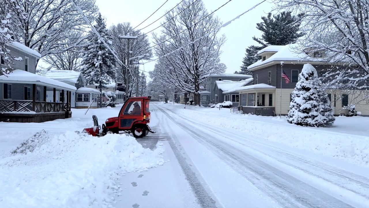
New York—New York City and the surrounding Tri-State region woke up to a snow-covered landscape Sunday after a fast-moving winter storm pushed through the Northeast, dumping several inches of snow and setting the stage for dangerous cold and icy travel conditions heading into the new week.
The storm delivered some of its heaviest snowfall across Long Island and central New Jersey, where totals exceeded six inches in multiple communities, while much of New York City and nearby suburbs saw moderate but impactful accumulations.
As snowfall tapered off Sunday afternoon, strong winds and plunging temperatures followed closely behind, locking in icy conditions overnight.
Storm winds down, cold air moves in
Snow gradually ended late Sunday morning across most of the region, though parts of eastern Long Island did not fully clear until around mid-afternoon. As the system pulled offshore, winds increased with gusts between 25 and 35 mph, especially near the coast.
Meteorologists warned that the combination of leftover snow, falling temperatures, and gusty winds would lead to dangerous wind chills, making it feel like the single digits — and potentially below zero in some spots by Sunday night. Another surge of Arctic air moving into the region means roads and sidewalks could remain slick well into Monday morning, particularly on bridges, overpasses, and untreated surfaces.

Snowfall totals across New York
While snowfall amounts varied by location, several areas across New York recorded notable accumulations, especially in Suffolk and Nassau counties on Long Island.
Among the higher totals reported:
- Commack, Suffolk County – 8.5 inches
- East Northport, Suffolk County – 8 inches
- Islandia, Suffolk County – 7 inches
- Merrick, Nassau County – 6.1 inches
- Grasmere, Staten Island – 6.1 inches
- Bayside, Queens – 5.5 inches
- Hartsdale, Westchester County – 5.3 inches
Within New York City, snowfall ranged from just under 3 inches in Central Park to over 6 inches in parts of Staten Island, marking one of the more impactful December snowfalls in recent years.
New Jersey sees some of the highest totals
New Jersey emerged as one of the hardest-hit states during the storm, with several counties measuring more than 8 inches of snow. The heavier totals contributed to difficult travel and increased strain on local road crews.
Top reports from New Jersey included:
- Colts Neck, Monmouth County – 8.2 inches
- Toms River, Ocean County – 8.1 inches
- Cranbury, Middlesex County – 7.3 inches
- Millburn, Essex County – 7 inches
- Bridgewater, Somerset County – 6.6 inches
- Union, Union County – 6 inches
Officials across the state urged drivers to stay off the roads during the storm’s peak and reminded residents that refreezing could cause lingering hazards overnight.
Connecticut records moderate accumulations
Southern Connecticut also picked up several inches of snow, particularly in Fairfield County. While totals were generally lower than in New Jersey and Long Island, conditions were still enough to disrupt travel and daily routines.
Reported totals included:
- Norwalk – 5.5 inches
- Greenwich – 5.1 inches
- Bridgeport – 4.5 inches
- Ridgefield – 3.8 inches
- Bethel – 2.6 inches
Icy travel concerns linger into Monday
With temperatures dropping rapidly Sunday night, black ice remains a major concern across the Tri-State Area. Officials warn that even roads that appear clear may become slick as melted snow refreezes.
Read Also: Southwest Kansas Warms Up as Dodge City Nears 60 Degrees This Week

Drivers are encouraged to slow down, increase following distance, and allow extra time for Monday morning travel. Pedestrians should also exercise caution, as sidewalks and steps may be icy through early Monday.
Winter pattern remains active
Forecasters say this storm is another reminder that winter is settling in across the Northeast. While some moderation in temperatures is possible later in the week, additional cold snaps and wintry systems remain possible as December continues.
Residents are advised to monitor updated forecasts and prepare for changing conditions as the region transitions deeper into winter.
How much snow did your area receive? Did conditions match what you expected? Share your local totals and experiences in the comments.