
Arkansas is gearing up for a significant change in weather this week, with forecasts predicting heavy rainfall across the state. The calm weather on Monday will give way to much wetter conditions by Wednesday, and residents should be prepared for potentially hazardous road conditions as a slow-moving storm system moves in. The National Weather Service (NWS) has issued a warning for possible flooding and poor visibility on the roads, particularly for those traveling on major highways.
On Tuesday, Arkansas will enjoy mostly sunny skies with temperatures reaching around 60°F during the day. However, the calm will not last long, as the rain will begin to move into the state by Wednesday. Drivers, especially those on major routes such as Interstate 40, should anticipate slick conditions and limited visibility.
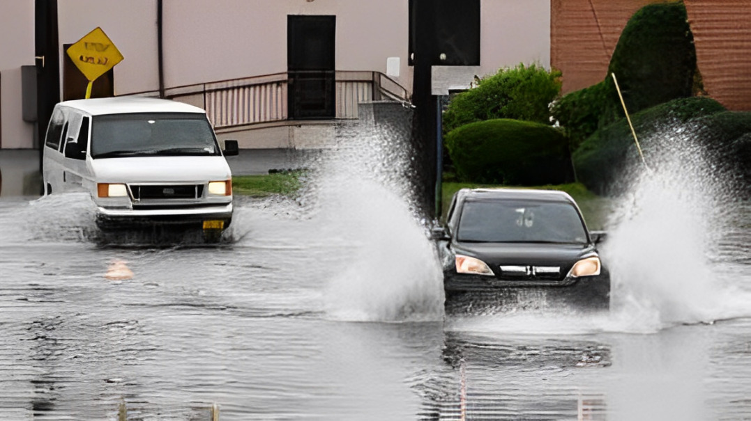
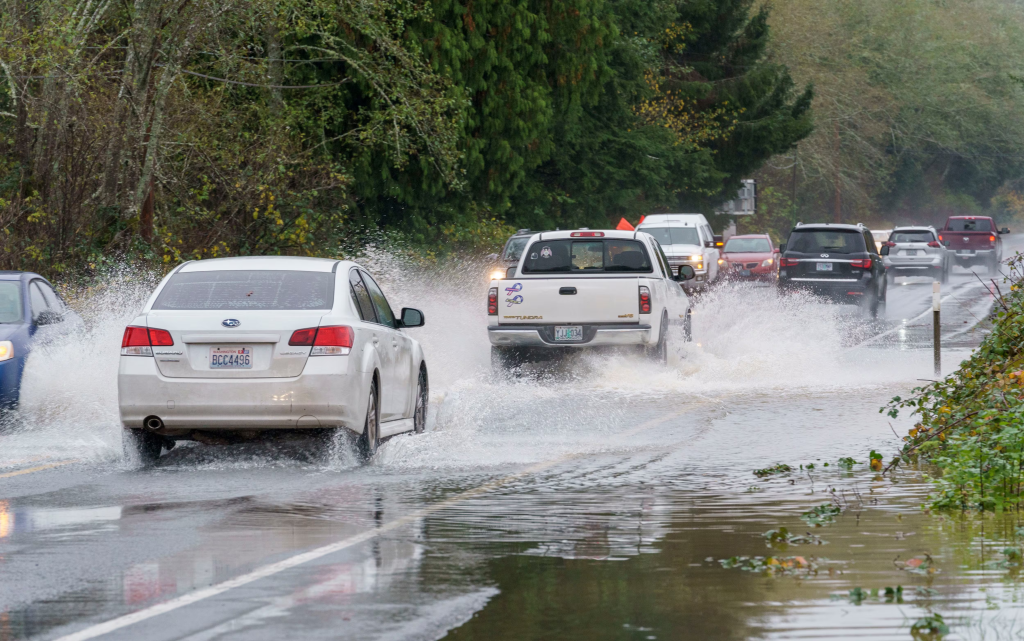
With rain expected to intensify throughout the day, some areas could see rainfall totals surpassing four inches by the time the storm system moves out on Friday. This amount of rainfall could create dangerous driving conditions, as roads will be slick and hard to navigate in heavy rain.
The heaviest rainfall is expected to occur on Thursday night, when conditions will be at their worst. As the rain intensifies, the risk of localized flooding increases, particularly in low-lying areas that are more susceptible to water accumulation.
The NWS has advised residents to stay aware of weather warnings as the storm progresses. Southeast winds will also contribute to the challenging conditions, with gusts up to 20 mph, further affecting visibility and adding to the dangers for travelers.
The NWS has emphasized that while some areas will experience heavy rainfall, the total amount of rain will not be uniform across the entire state. Some locations could see up to four inches of rain, while other areas will experience more moderate amounts.
It’s important for Arkansans to pay attention to local forecasts and plan accordingly, especially if they live or work in regions prone to flooding. Those in flood-prone areas should take extra precautions by ensuring that gutters and drainage systems are clear of debris to minimize flooding risks.
As the rain begins to fall on Wednesday, roadways will become slick, and drivers should exercise caution when navigating highways and city streets. Visibility will be significantly reduced in areas of heavy rain, making it difficult to see other vehicles or potential hazards.
Drivers are advised to reduce their speed and increase following distance to allow for safer travel in these conditions. The NWS warns that even minor accidents could become more dangerous with wet roads and reduced visibility.
Residents should also be aware that the storm could cause power outages. Heavy rainfall, coupled with winds, could bring down tree branches or power lines, leaving some areas without electricity. To prepare for possible outages, it’s a good idea to have emergency supplies on hand, such as flashlights, batteries, and non-perishable food. Having a backup power source for essential devices could also prove useful, especially for those who rely on medical equipment or other necessities that require power.
In addition to the flooding risks, the storm will also bring cooler temperatures to the state. After the heavy rain moves through, temperatures are expected to stabilize by Friday, with highs reaching around 64°F. However, the cooler weather will not last long, as temperatures are predicted to drop once again over the weekend. While the rain will subside by Friday, the cold front moving in will bring another round of chilly conditions, so residents should be prepared for fluctuating temperatures throughout the week.
Given the potential for widespread rainfall and road hazards, Arkansas drivers should plan their travel accordingly. Those who do not need to be on the roads during the heaviest rainfall on Thursday night and Friday should consider postponing their trips.
For those who must travel, it’s important to stay up to date with the latest weather reports and alerts from the NWS. Many local news stations and radio stations will broadcast weather updates, and smartphone apps can also provide real-time information on road conditions.
In preparation for the storm, local authorities are working to ensure that storm drains and flood-prone areas are clear of debris. Residents are urged to assist by removing leaves and other obstructions from drains around their homes. It’s also a good time to inspect personal property, such as gutters, to ensure they are in working order. If there are any concerns about the structural integrity of a home or business, it’s best to address them before the storm hits.
For those living in areas with a history of flooding, the NWS recommends that flood watches and warnings be closely monitored. These advisories will provide information on areas most at risk for flooding and guide residents on evacuation plans if necessary. Having an emergency kit ready, along with a family emergency plan, can be the difference between being prepared and being caught off guard.
With the heavy rain expected to last through the end of the week, it’s essential that Arkansas residents remain vigilant and informed. Whether it’s taking precautions before the storm or staying aware of the latest weather updates, planning ahead can help minimize the impact of the storm. By staying prepared and exercising caution, residents can navigate this wet weather stretch with greater safety.
As the storm progresses, it’s crucial for Arkansans to be weather-aware. Following safety tips, like staying off the roads during peak rain hours and preparing for possible power outages, will help keep everyone safe. The National Weather Service will continue to issue updates as the storm unfolds, and residents are urged to stay informed to protect themselves, their families, and their properties.
Disclaimer: This article has been meticulously fact-checked by our team to ensure accuracy and uphold transparency. We strive to deliver trustworthy and dependable content to our readers.