HPP– A significant storm classified as a bomb cyclone hit the East Coast with intense wind and rain on Wednesday night into Thursday morning. According to AccuWeather meteorologists, the storm’s pressure fell by 0.71 inches of mercury (24 millibars) in under 24 hours from Wednesday to Thursday morning.
A significant storm impacted more than a dozen states, resulting in over 100 reports of wind damage stretching from North Carolina to Maine. Eastern Maine experienced the most wind damage reports, leaving 90,000 customers without power on Thursday morning, which is over 10% of the state’s customers, as reported by PowerOutage.
Aroostook County in the US experienced widespread power outages, leaving over half of its customers without electricity. Trenton and Bar Harbor recorded wind gusts reaching 67 mph.

Bill Wadell from AccuWeather provided a live report from the Hamptons on Long Island, highlighting the flooding and strong winds affecting various locations along the East Coast. Waddell pointed out that, aside from causing flooding, the heavy rain was a welcome sight in the Northeast, which has been grappling with a severe drought and wildfires recently dominating the weather reports.
A powerful storm system has caused significant rainfall across the eastern United States, stretching from Louisiana to Maine. Record-breaking rainfall was observed in at least nine areas across the Northeast, such as Avoca, Pennsylvania; Burlington, Vermont; Worcester, Massachusetts; Providence, Rhode Island; and Boston.

Rhode Island experienced the most significant rainfall, exceeding 5 inches. The Providence record reached 4.6 inches, almost doubling the former record of 2.4 inches established on December 11, 1992.
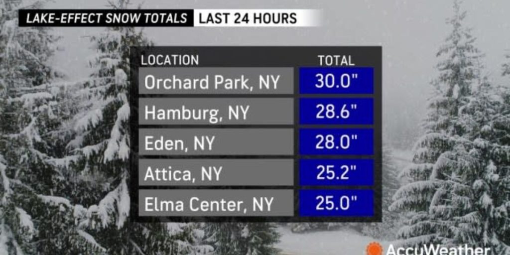
In the aftermath of the storm, significant lake-effect snow accumulated in areas southeast of the typical Great Lakes snow belts, with Orchard Park, New York, just south of Buffalo, recording 30 inches. Nearby towns recorded 25-30 inches by noon on Thursday. Snowfall is expected to persist until Friday.
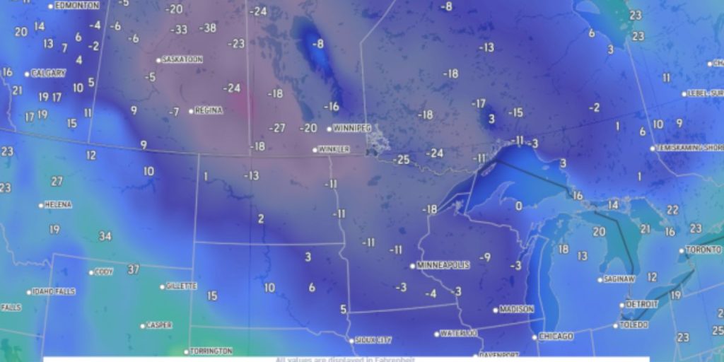
Cold air, the chilliest since last winter, is moving into the eastern U.S. on Thursday. International Falls, Minnesota, started the day at a frigid 24 degrees below zero, as temperatures near zero moved closer to Chicago and parts of Iowa. Cold air is set to reach Florida, with temperatures in the southwestern region expected to drop into the 30s on Thursday night.

