HPP– A significant wintry precipitation is expected to lead to slippery roads and considerable airline delays as the week comes to an end, according to meteorologists at AccuWeather.
A storm system is set to deliver rain and mountain snow from Washington to Northern California starting Wednesday night and continuing into Thursday. It will then shift its path across the north-central United States from Friday evening through Saturday.
As the storm approaches the trailing edge of the retreating Arctic air, forecasters caution that wintry precipitation will develop, potentially leading to hazardous conditions on the roads.
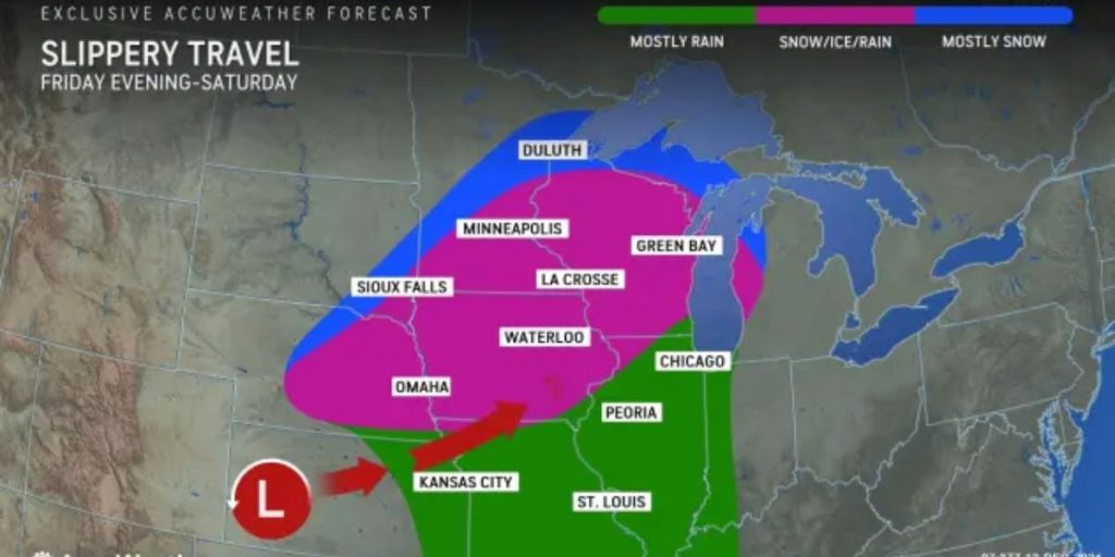
The upcoming storm is expected to traverse the interior West from Thursday night into Friday, bringing with it light and scattered precipitation. As the storm moves eastward from the Rockies, it will draw in moisture from the Gulf of Mexico. A mix of rain, ice, and snow is expected to develop on Friday, spreading toward the Great Lakes area by Friday night and into Saturday.
A wintry mix is set to start in Omaha, Nebraska, on Friday, rapidly spreading to the Northeast by Friday night along the Interstate 80, 90, 94, and 35 corridors, impacting Des Moines, Iowa; Minneapolis, and Madison, Wisconsin.
Due to the updated path and timing of the storm, meteorologists at AccuWeather anticipate that Chicago, Detroit, and likely Milwaukee will experience only rain. Inclement weather, including rain, fog, and a low cloud ceiling, may result in potential flight delays.

While significant wintry precipitation is unlikely in areas near and north of the storm track, there will still be enough to create slippery conditions on some roads. A mere thin layer of clear ice or slush can significantly elevate the risk of accidents.
Precipitation is expected to occur south of the storm path, affecting areas from a large portion of Missouri to Ohio and southern Michigan, along with the Tennessee and lower Mississippi valleys.
As the storm progresses on Saturday, the wintry mix could transition into a spell of wet snow across the central and northern Plains.
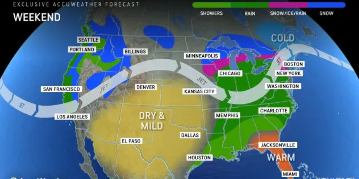
This weekend, the same storm is set to move into the Northeast, bringing the potential for a wintry mix, ice, or even all snow in certain areas of upstate New York and New England, where temperatures may dip low enough.
The atmosphere following the storm originates from the Pacific Ocean, indicating that another lake-effect occurrence is not expected. Another storm is expected to emerge from the West early next week, potentially bringing stronger gusty winds and a touch of cold air.
This could result in heavier snowfall across parts of the western Great Lakes from Monday night into Tuesday, followed by a period of lake-effect snow extending into midweek.

