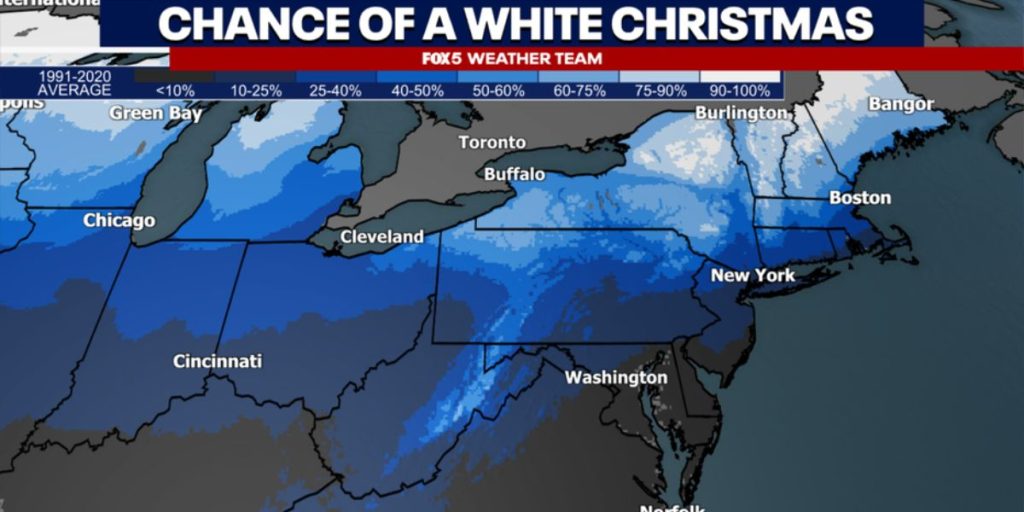
HPP– Snow for Christmas in the DC area might be on the table, but past trends suggest otherwise. Fewer than ten percent of recorded years show measurable snowfall on Christmas Day in D.C.
What was the most recent occurrence of snow on Christmas in the DC region?
More than 20 years have passed since the last measurable snowfall on Christmas Day, which was 0.2 inches in 2002. Additionally, it’s been over 50 years since the city experienced more than an inch of snow on this holiday, with 4.3 inches recorded in 1969.
Washington, D.C. has recorded more than one inch of snow on Christmas Day just four times since reliable records began in the 1880s.
If you consider the snow already on the ground as part of a white Christmas, your chances improve slightly, but not by much. In 2009, D.C. was notably covered in more than six inches of snow after the significant blizzard that hit on December 18th-19th.
A historic storm brought 16.4 inches of snow to the city, marking the worst December blizzard ever recorded in D.C. Thirteen Christmas Days have seen more than one inch of snow on the ground.

The 1960s saw the highest frequency of snow on the ground for Christmas Day, with four occurrences during that decade.
What can we anticipate for the approaching holiday season?
Weather models are starting to provide early forecasts for the Christmas season. Initial predictions from the National Weather Service suggest that temperatures in the eastern part of the country will be around normal to slightly below normal in the week before Christmas.
There is strong confidence that the western part of the country will experience warmer than usual temperatures.
Another Chilly Wave is approaching the DC Area
Following a chilly conclusion to this week, forecasts are indicating a return to warmer conditions for the majority of the upcoming workweek. Temperatures could reach over 60°F again on Tuesday afternoon but expect several opportunities for rain alongside the warmer weather.
As we approach the end of next week, forecasts are consistently indicating a significant surge of cold air moving into the D.C. area.
A robust ridge across the western United States will move northward into Canada, Alaska, and the Arctic Circle by the end of the week, pushing cold polar air southward into the eastern part of the country. A significant cold air surge is expected to occur next weekend as we approach the Christmas holiday.

